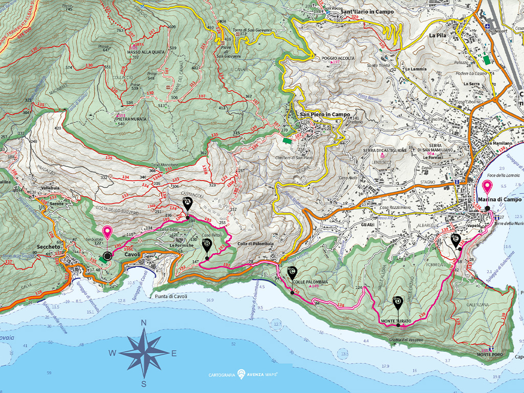
Departure:
Seccheto
Arrival: Marina di Campo
Average time: 3
hours 30 minutes
Length: 8.1
km
Ascent: 435.2
m
Descent: 503
m
Maximum altitude:
252.7 m
Minimum altitude:
1.8 m
Maximum slope:
58.7%
Trail difficulty:
Medium
Trail numbers: No.
195, 193, 192, 138
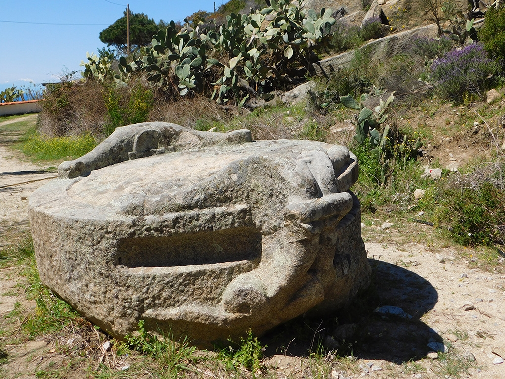
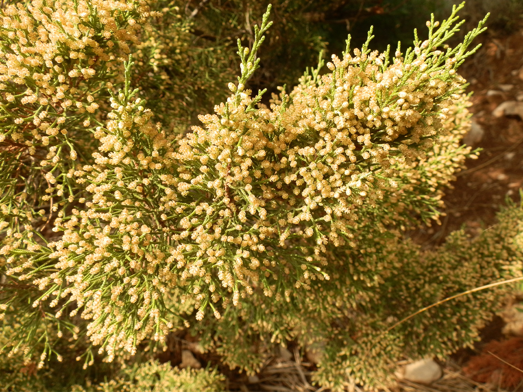
The Via dei Ginepri begins near the sports field in Seccheto, taking path no. 195. The first part of the route coincides with the Vie del Granito ('granite trails'), a network of paths leading to various ancient granite artifacts and prehistoric sites.
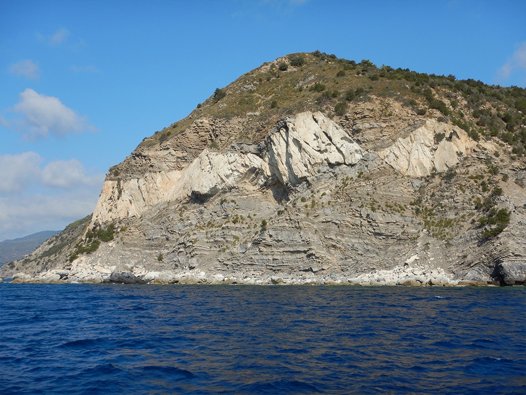
It then continues on panoramic paths (no. 193 and 192), featuring the fractured rocks typical of the thermal metamorphic ring, as far as the surfaced road which we will follow for a short stretch. After taking the Palombaia hill track, which continues as a path (no. 138), the moves breaks away from the Capanne massif and heads across some foothills mainly consisting of sedimentary rock. Parts of the path follow the coast, overlooking the sea, once covered with cultivated terraces, with exposed areas along the cliff, sometimes entering the woody vegetation of the northern slopes. This leads us above the Galenzana beach, and we then descend near the older nucleus of the village of Marina di Campo.